Image and video credits
Photography and video on this site are licensed from third parties unless stated otherwise. They are not Bristol Drone’s own work, and they are used under the licences listed below.
Every photograph used on the site is credited in full on this page: what it shows, who made it, its licence and a link to the original. Every page links here from its footer. Photos have been cropped and resized for this website; adapted CC BY-SA images are shared under the same licence as the original. The background video and its poster frame are Mixkit stock footage, used under the Mixkit licence, and the photo in the home page’s booking section is licensed stock photography.
Home page background video
-
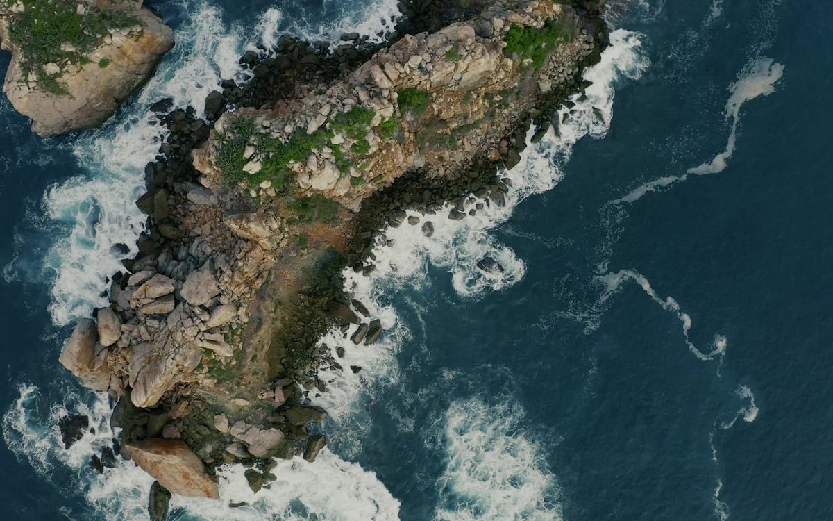
Cliffs in the sea aerial shot
Top-down drone shot drifting over a rocky islet in deep blue sea: grassy rock ringed by white surf, with a smaller islet to one side. The location is not stated by the source.

Photographs
-
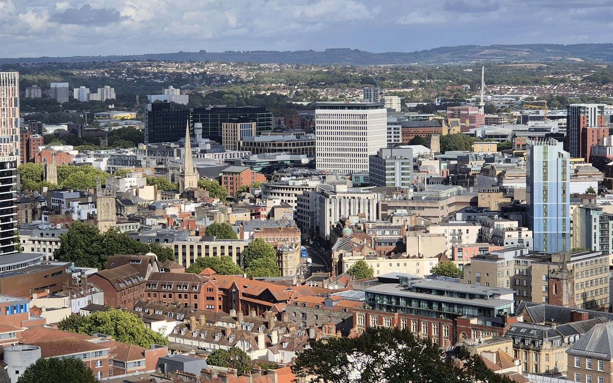
Bristol city centre from Cabot Tower
Wide, high view from the Cabot Tower observation deck across Bristol city centre: a dense roofscape of red-brick and stone buildings, church spires and towers, several modern tower blocks, and green hills on the horizon. Sunny, with blue sky and scattered clouds.
- Author
- Captain Galaxy
- Licence
- CC BY 4.0
- Source
- Cabot Tower View - The Centre, Redcliffe and Bristol Old City - August 2025 (Wikimedia Commons)
- Changes
- Cropped and resized for this website
-
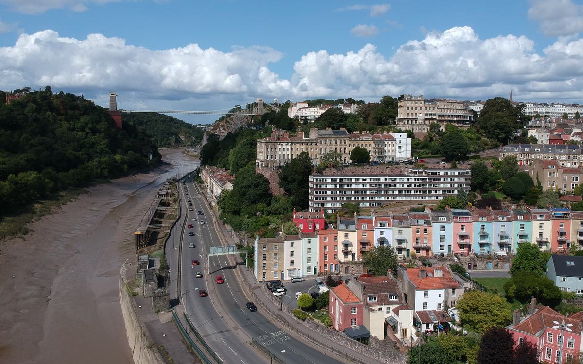
Painted terraces above the River Avon, Bristol
Drone photo over the tidal River Avon and the dual carriageway beside it, looking up the Avon Gorge towards Clifton Suspension Bridge. On the right are rows of pastel-painted terraced houses (pink, blue, mint, cream, red) climbing the hillside, with Georgian terraces above. Bright blue sky with white cumulus clouds.
- Author
- damo1977
- Licence
- CC BY 2.0
- Source
- Aerial View of River Avon with Clifton Suspension Bridge (Flickr)
- Changes
- Cropped and resized for this website
-
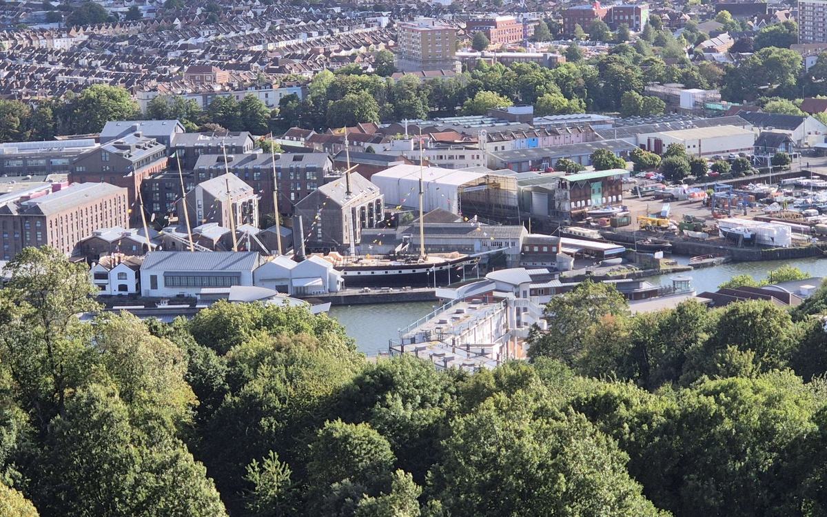
The Floating Harbour and SS Great Britain from Cabot Tower, Bristol
Sunny, high view from the Cabot Tower observation deck over Bristol's Floating Harbour. At centre is the SS Great Britain in its dry dock with rigging flags, surrounded by Spike Island warehouses and new apartment blocks. At right is a marina and boatyard full of small boats. A band of harbour water runs across the middle. Bedminster/Southville terraced roofs are at the top, and a band of Brandon Hill treetops fills the lower third.
- Author
- Captain Galaxy
- Licence
- CC BY 4.0
- Source
- Cabot Tower View - SS Great Britain and Spike Island - August 2025 (Wikimedia Commons)
- Changes
- Cropped and resized for this website
-
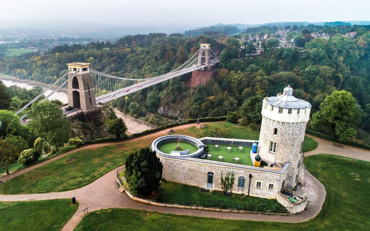
Clifton Suspension Bridge and Clifton Observatory, Bristol
Drone photo of Clifton Suspension Bridge crossing the wooded Avon Gorge. Clifton Observatory (a round stone tower with a walled roof terrace) sits on the grass of Clifton Down in the foreground. Autumn greens, the river at low tide, pale hazy sky along the top edge.
- Author
- Chris Lathom-Sharp
- Licence
- CC BY-SA 4.0
- Source
- Clifton Suspension Bridge and the Observatory in Bristol, England (Wikimedia Commons)
- Changes
- Cropped and resized for this website
-
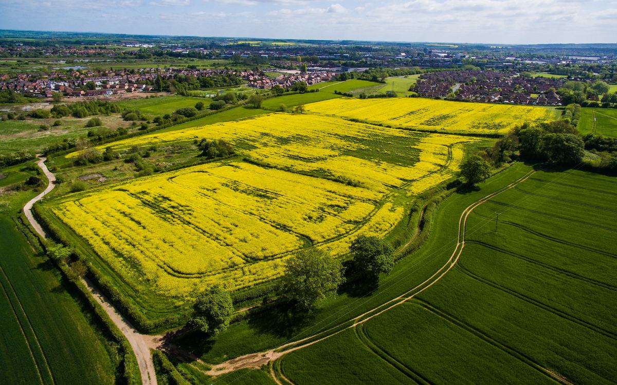
Oilseed rape and crop fields near Stafford
Oblique drone view over farmland on a sunny spring day. Two fields of bright yellow flowering oilseed rape lie in the centre, bordered by hedgerows and trees. In the foreground is green wheat with curving tractor tramlines and a farm track, with a winding lane on the left. Red-brick housing estates and the town of Stafford sit on the horizon under a blue sky with white cumulus.
- Author
- William Hook
- Licence
- CC BY-SA 2.0
- Source
- Fields near Stafford (Flickr)
- Changes
- Cropped and resized for this website
-
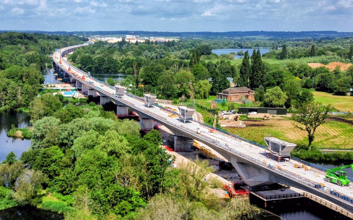
HS2 Colne Valley Viaduct under construction
Elevated drone view of the HS2 Colne Valley Viaduct under construction: a curving concrete deck with parapet formwork units, a telehandler and site compounds, crossing lakes and dense green woodland under a blue sky with light cloud.
- Author
- 42 Walkers
- Licence
- CC BY 4.0
- Source
- Curve of the Colne Valley Viaduct.jpg (Wikimedia Commons)
- Changes
- Cropped and resized for this website
-
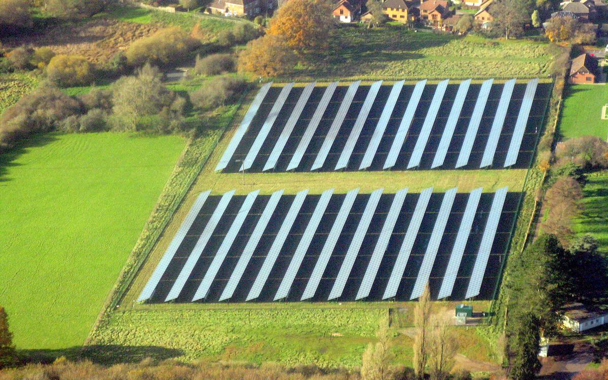
Solar farm at Otterbourne, Hampshire
Aerial view of a small ground-mounted solar farm: two blocks of angled panel rows in a fenced grass field with an inverter cabin. A bright green meadow lies to the left, with autumn trees and a row of brick houses above.
- Author
- M J Richardson
- Licence
- CC BY-SA 2.0
- Source
- Solar farm at Otterbourne - geograph.org.uk - 5612848.jpg (Wikimedia Commons)
- Changes
- Cropped and resized for this website
-
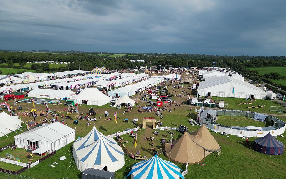
National Eisteddfod of Wales showground, 2023
Drone view over a large outdoor festival ground on grass. In the foreground are blue-and-white striped circus-style tents, bell tents and tipis; behind them are rows of white marquee avenues full of visitors. The ground is sunlit under a dark stormy sky, with Welsh countryside beyond.
- Author
- Llywelyn2000
- Licence
- CC BY-SA 4.0
- Source
- Eisteddfod Genedlaethol Cymru Llŷn ac Eifionydd 2023 o'r awyr 01.jpg (Wikimedia Commons)
- Changes
- Cropped and resized for this website
-

A cinema drone (DJI Inspire 1) near Piz Kesch in the Swiss Alps
A professional camera drone (DJI Inspire 1 with a Zenmuse X5 gimbal camera) hovering head-on against a deep blue sky, with red arm lights on and snow-covered Alpine peaks along the bottom of the frame.
- Author
- Capricorn4049
- Licence
- CC BY-SA 4.0
- Source
- DJI Inspire Zenmuse X5 PRO hovering over Piz Kesch, picture taken on Älplihorn 1.jpg (Wikimedia Commons)
- Changes
- Cropped and resized for this website
-
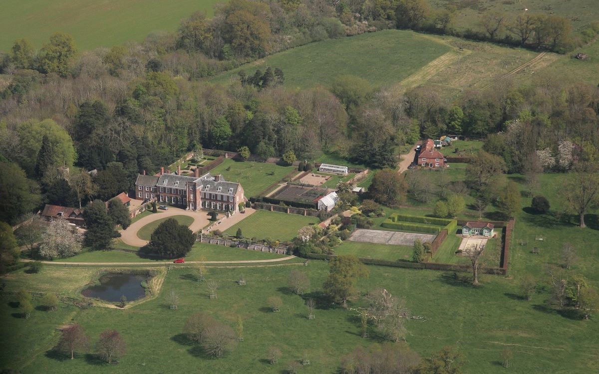
Harrington Hall and its gardens, Lincolnshire
Oblique aerial view of a red-brick country house with a circular gravel drive. Beside it are walled gardens, glasshouses, a tennis court, a pond and parkland trees, surrounded by spring woodland and green fields.
- Author
- Chris
- Licence
- CC BY-SA 2.0
- Source
- Harrington Hall, aerial 2025 (3) - geograph.org.uk - 8028731.jpg (Wikimedia Commons)
- Changes
- Cropped and resized for this website
-
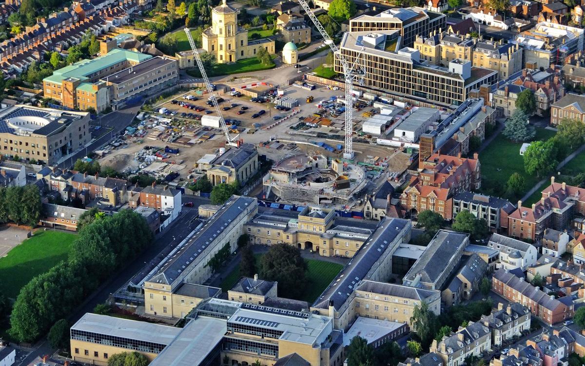
Radcliffe Observatory Quarter development, Oxford
Oblique aerial photo from a light aircraft of the Radcliffe Observatory Quarter development in Oxford. Two tower cranes stand over a cleared site with a site compound, parked cars, materials and a circular building in scaffolding. Around it are honey-stone college buildings, Victorian brick terraces, lawns and trees, in warm evening light.
- Author
- Dave Price
- Licence
- CC BY-SA 2.0
- Source
- Aerial View of Oxford's Radcliffe Observatory Quarter development (Wikimedia Commons)
- Changes
- Cropped and resized for this website
-
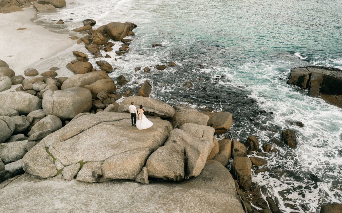
A wedding couple photographed from a drone above the sea
Elevated drone photo of a couple (white dress, white shirt and dark trousers), seen from behind, standing on smooth granite boulders beside a sandy cove and a turquoise sea with white surf. The location is not stated by the source.
- Author
- Pexels contributor
- Licence
- Pexels License
- Source
- Pexels photo 8204444 (pexels.com)
- Changes
- Cropped and resized for this website
-
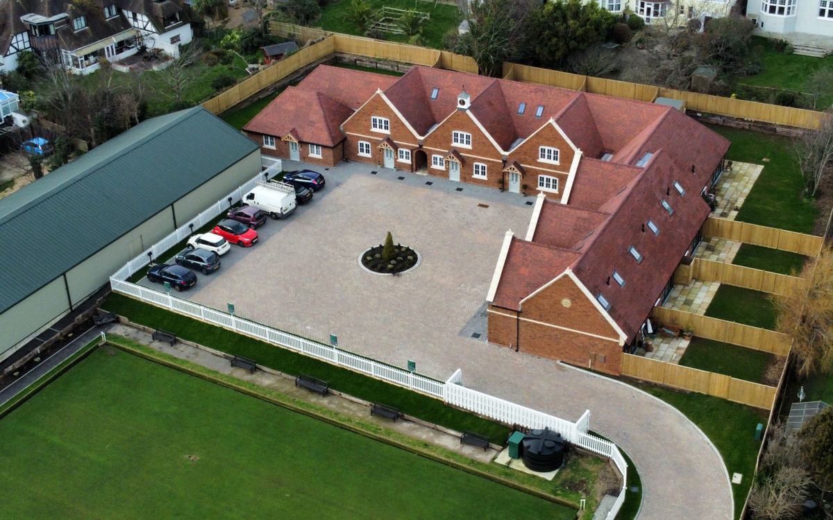
Gullivers Mews, a small new-build development in Bexhill
Oblique drone view of a mews of eight new red-brick houses around a block-paved courtyard. They have clay-tile roofs with rooflights and a clock cupola, fenced private gardens with patios, a curved private drive and a few parked cars. A large bowling green is in the foreground and older houses and trees are behind.
- Author
- Alexis Markwick
- Licence
- CC BY-SA 4.0
- Source
- Gullivers Mews, Bexhill (aerial) (Wikimedia Commons)
- Changes
- Cropped and resized for this website
-
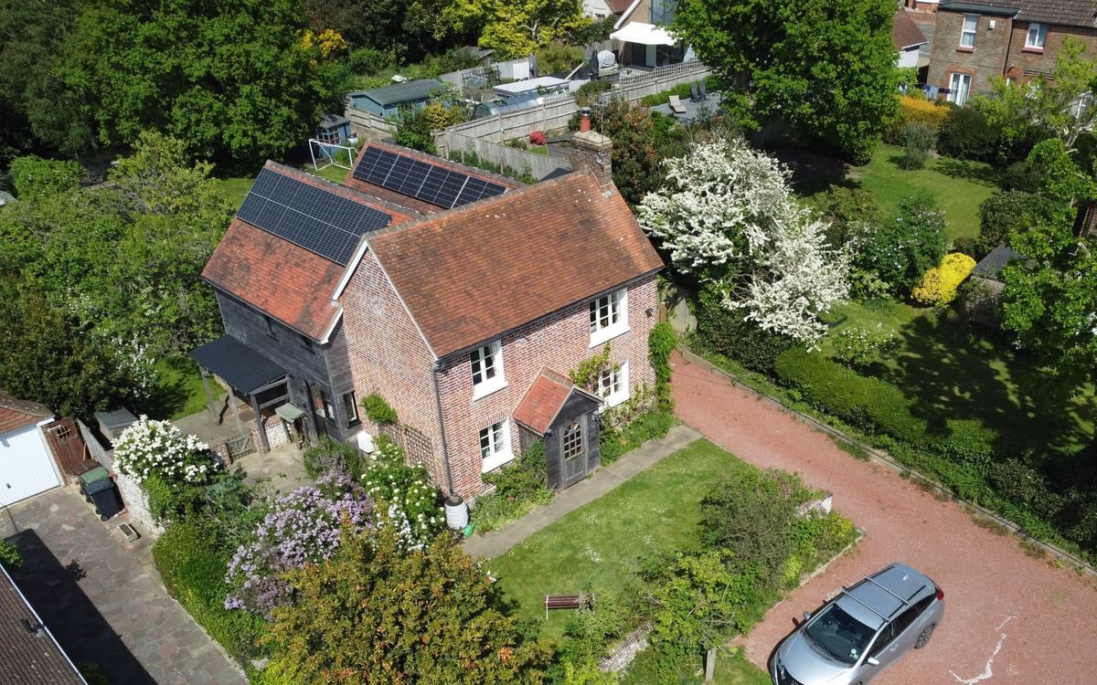
Tiled cottage roofs, Bexhill, East Sussex
Close oblique drone shot of a detached red-brick cottage. You can see its clay-tile gable roofs, a brick chimney stack, a small porch roof and two banks of solar panels on the rear roofs. Around it are blossoming trees, lawns and a gravel drive with one parked silver car. Sunny spring light, vivid greens and terracotta.
- Author
- Alexis Markwick
- Licence
- CC BY 4.0
- Source
- Nab Cottage, 20 Broadoak Lane, Bexhill (aerial) (1) (Wikimedia Commons)
- Changes
- Cropped and resized for this website
-
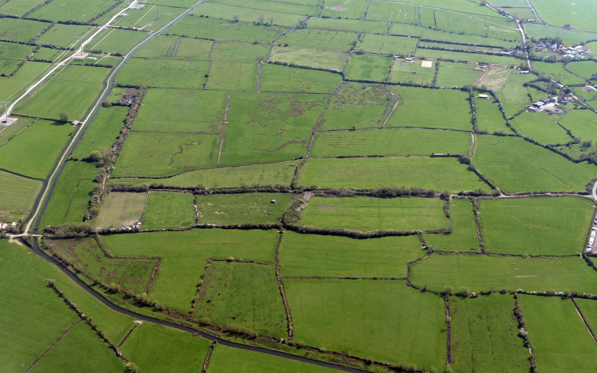
Fields and rhynes on Puxton Moor, North Somerset Levels
Steep oblique aerial view of flat green pasture on the North Somerset Levels. Rectangular fields are divided by hedges and water-filled drainage channels (rhynes), with a winding rhyne across the foreground, farm buildings at top right and a pylon line at top left. Vivid spring green, map-like grid.
- Author
- Adam Cli
- Licence
- CC BY-SA 4.0
- Source
- Puxton Moor 2 (Wikimedia Commons)
- Changes
- Cropped and resized for this website
-
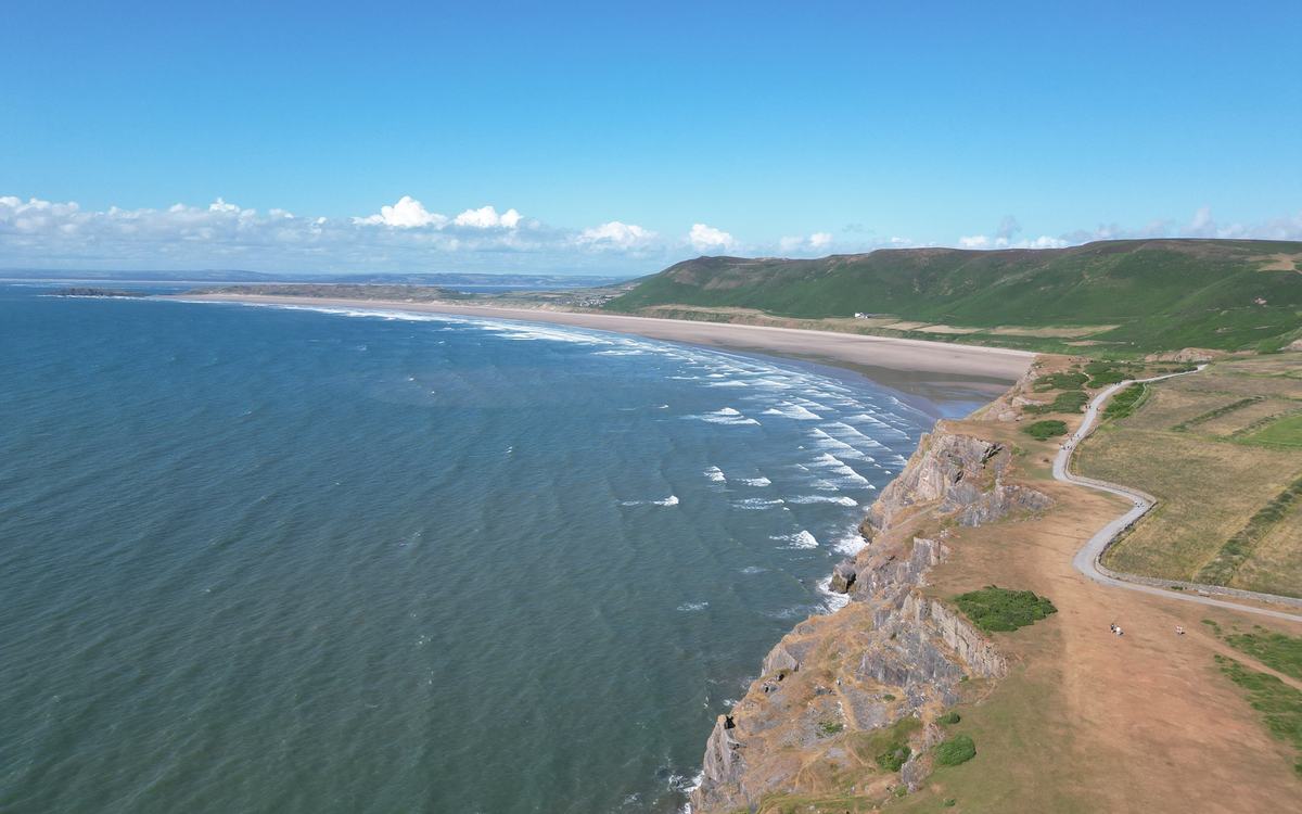
Rhossili Bay from the clifftops, Gower Peninsula
High drone view from above the limestone cliffs at Rhossili, looking north along a long curving sandy beach with rolling white surf. A green down rises behind the beach, a clifftop path winds along the right, and there is a deep blue-green sea and blue sky with a line of white cloud. A few tiny walkers are on the path. Cinematic and vivid.
- Author
- Llywelyn2000
- Licence
- CC BY-SA 4.0
- Source
- Aerial view of Worm's Head (Welsh - Pen Pyrrod), Rhossili, Penrhyn Gŵyr, Cymru (Wales) 05 (Wikimedia Commons)
- Changes
- Cropped and resized for this website
-
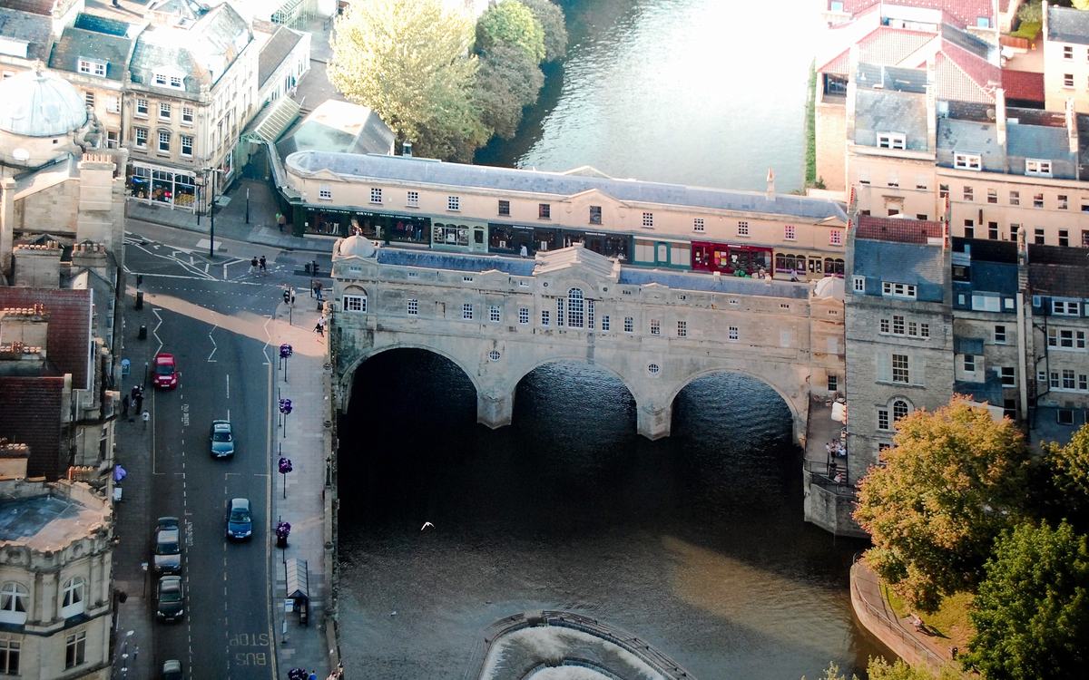
Pulteney Bridge and the River Avon, Bath
High oblique aerial view of Pulteney Bridge over the River Avon in Bath, with Georgian stone buildings, the top of the horseshoe weir, trees and Grand Parade road in warm evening light.
- Author
- cisko66
- Licence
- CC BY 3.0
- Source
- Pulteney Bridge, Bath - panoramio (1).jpg (Wikimedia Commons)
- Changes
- Cropped and resized for this website
-
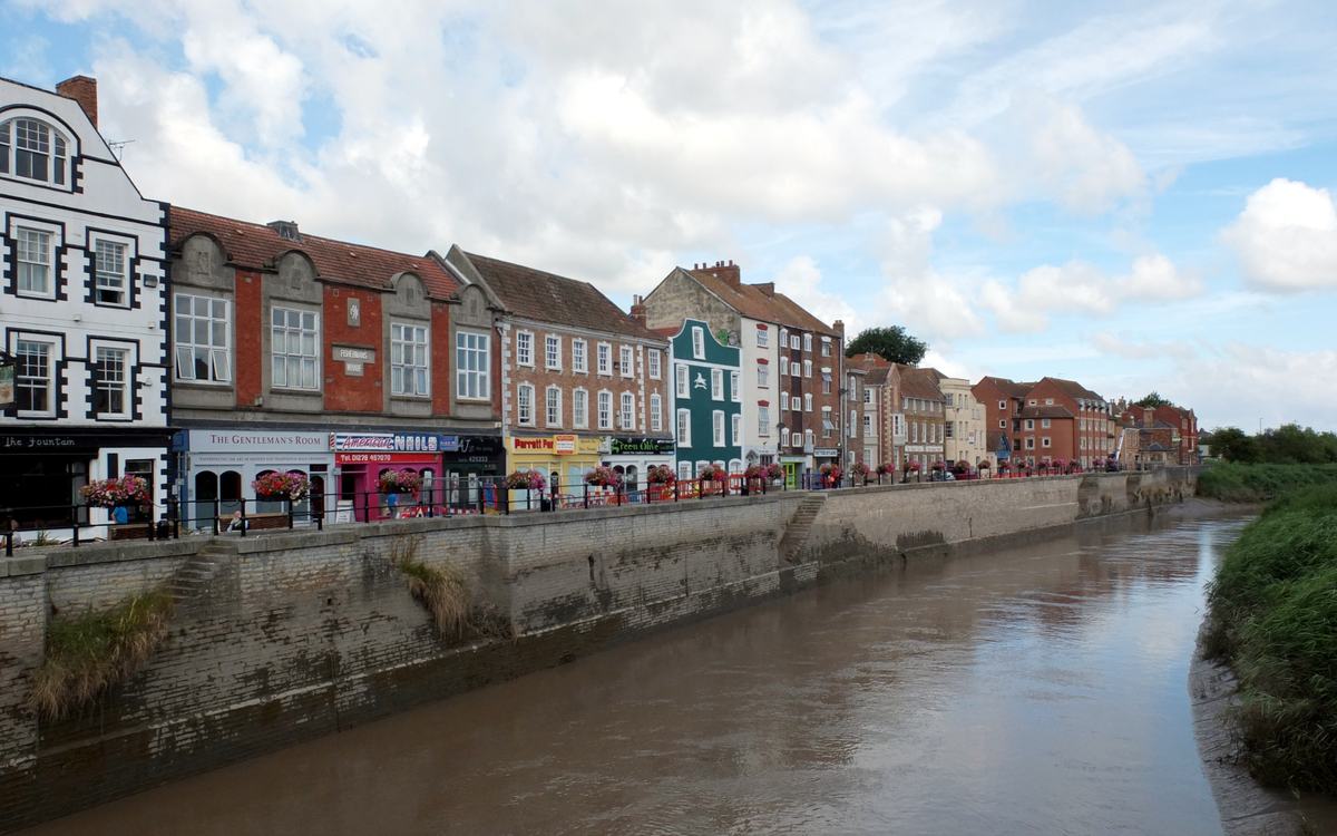
West Quay and the River Parrett, Bridgwater
Ground-level view from Town Bridge down the River Parrett. The colourful historic West Quay frontage (a black-and-white gabled building, red-brick and green-painted facades, hanging baskets) runs above the stone quay wall. Brown tidal water and a grassy far bank are at the right, under a bright blue sky with white clouds.
- Author
- habiloid
- Licence
- CC BY-SA 2.0
- Source
- The River Parrett and West Quay, Bridgwater - geograph.org.uk - 6732857.jpg (Wikimedia Commons)
- Changes
- Cropped and resized for this website
-
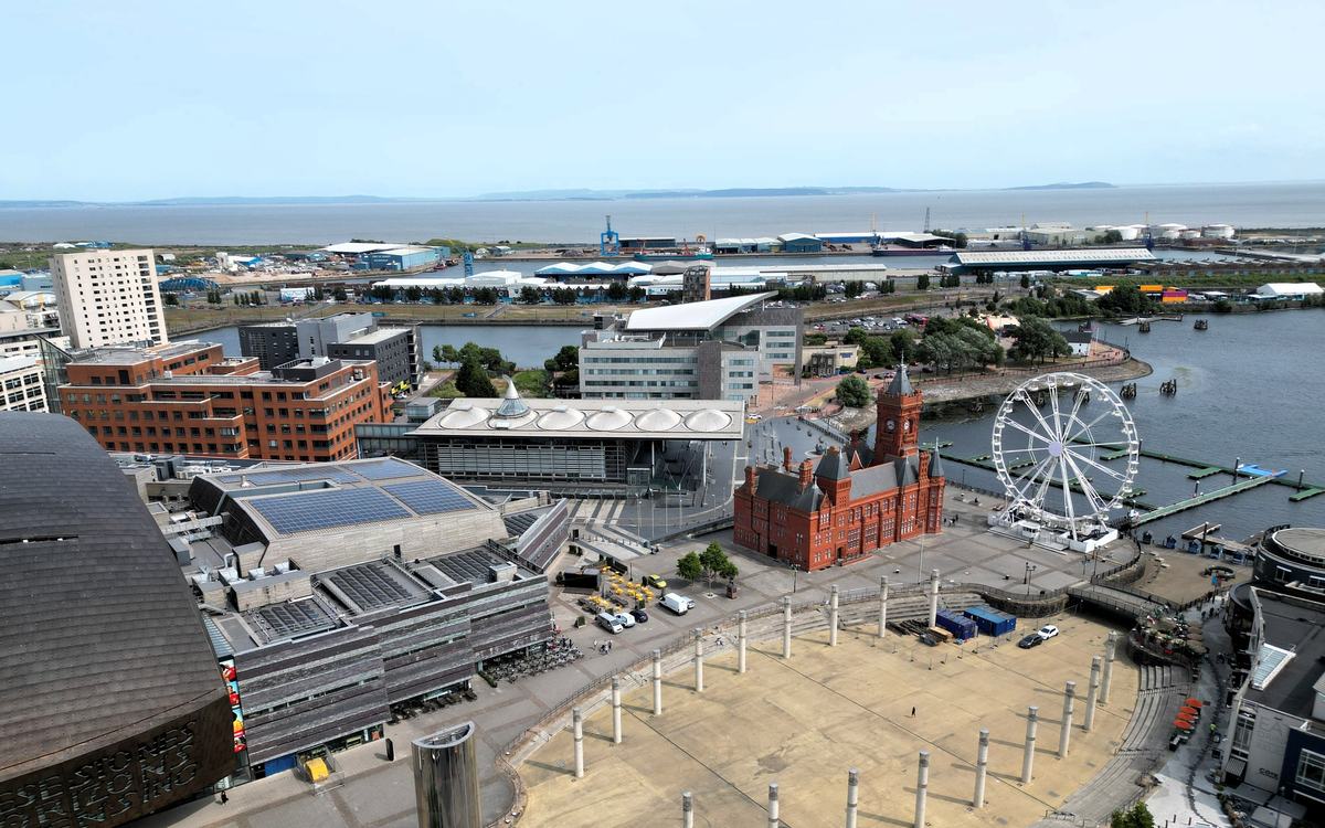
Cardiff Bay and the Pierhead Building
High oblique view, drone-like, over Cardiff Bay. The red-brick Pierhead Building with its clock tower sits in the centre, next to the Senedd with its slate steps and a Ferris wheel on the waterfront. Roald Dahl Plass with its steel columns is in the foreground, the Wales Millennium Centre's bronze roof is at the left edge, and docks and the Severn Estuary are on the horizon. The sky is pale blue and slightly hazy.
- Author
- Llywelyn2000
- Licence
- CC BY-SA 4.0
- Source
- The Pierhead Building, Caerdiff Bay, Wales - a Welsh Government building 08.png (Wikimedia Commons)
- Changes
- Cropped and resized for this website
-
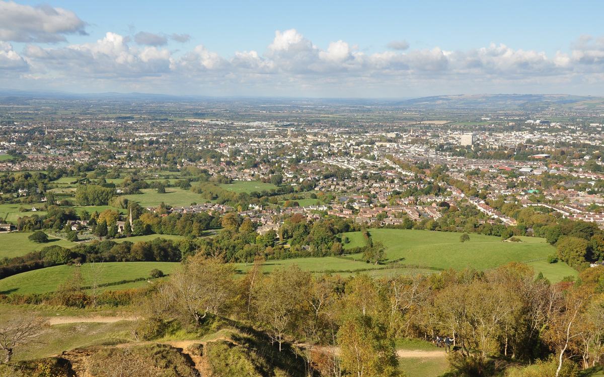
Cheltenham from Leckhampton Hill
Panoramic view from the Leckhampton Hill escarpment. Early-autumn trees and old quarry ground are in the foreground, with bright green fields and Leckhampton village in the middle and the whole of Cheltenham, its spires and towers, stretching to the horizon. Blue sky with a band of white cumulus. Sharp and well exposed.
- Author
- Nilfanion
- Licence
- CC BY-SA 4.0
- Source
- Cheltenham from Leckhampton Hill (6970).jpg (Wikimedia Commons)
- Changes
- Cropped and resized for this website
-
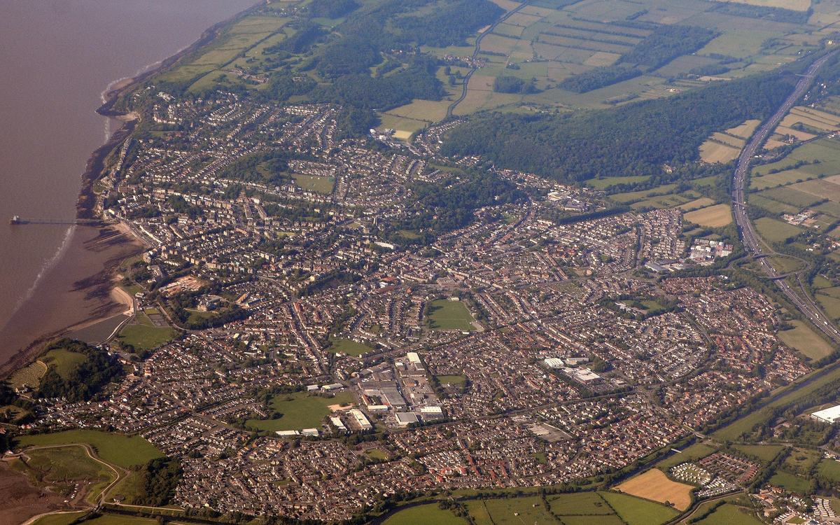
Clevedon and the Severn Estuary shore, North Somerset
Aerial view (from an aircraft) over the whole town of Clevedon in summer light: the Victorian pier and seafront on the Severn Estuary at left, the Marine Lake, dense housing, wooded hills, green and gold fields and the M5 motorway.
- Author
- Lewis Clarke
- Licence
- CC BY-SA 2.0
- Source
- North Somerset , Clevedon Scenery - geograph.org.uk - 5434033.jpg (Wikimedia Commons)
- Changes
- Cropped and resized for this website
-
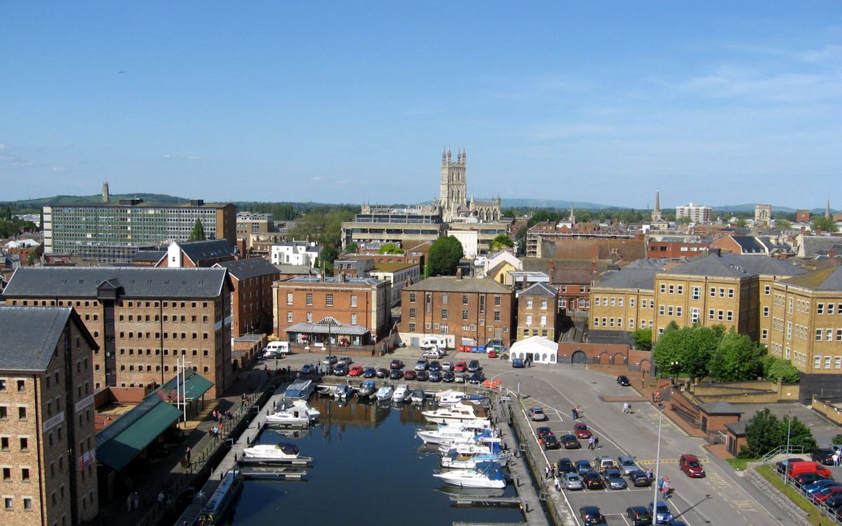
GlosDocks&Cathedral
High-vantage view looking down one of the Gloucester Docks basins: moored motor boats and a red narrowboat, Victorian brick warehouses on the left, a car park on the right, and the city behind with Gloucester Cathedral's tower centred on the skyline under a clear blue sky. Vivid, sunny, sharp at web sizes.
- Author
- Jongleur100
- Licence
- Public domain (PD-self)
- Source
- GlosDocks&Cathedral.JPG (Wikimedia Commons)
- Changes
- Cropped and resized for this website
-
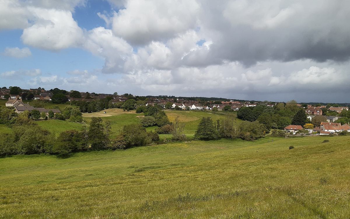
Keynsham from across the River Chew valley
Elevated view from a hillside meadow across the green Chew Valley on a bright May day. There is buttercup grassland in the foreground and trees and scrub along the valley floor. Keynsham houses, some with red-tiled roofs, line the far slope and horizon. The sky is blue with large white cumulus clouds, turning darker grey on the right. Two tiny, unidentifiable walkers are in the middle distance.
- Author
- hugh llewelyn
- Licence
- CC BY-SA 2.0
- Source
- Keynsham - 49935289301.jpg (Wikimedia Commons)
- Changes
- Cropped and resized for this website
-
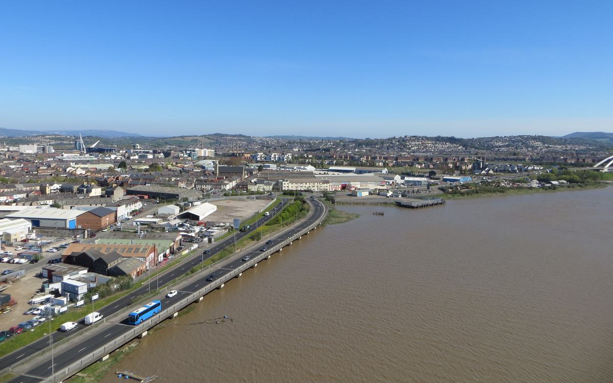
The River Usk from Newport Transporter Bridge
High view from the top of Newport Transporter Bridge, looking up the tidal River Usk towards Newport city centre and its surrounding hills. A riverside dual carriageway with a blue coach runs along the left bank, with warehouses and terraced streets beyond. The top half is deep, cloudless blue sky and the river is muddy brown.
- Author
- Alex Liivet
- Licence
- CC0 1.0
- Source
- Newport Transporter Bridge (17069219718).jpg (Wikimedia Commons)
- Changes
- Cropped and resized for this website
-
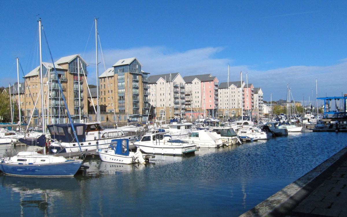
Portishead Marina
Portishead Marina on a sunny day: moored yachts and motor boats on blue water in front of tall sandstone, white and pink apartment blocks, under a deep blue sky with light cloud; quayside at right.
- Author
- Adrian Pingstone
- Licence
- Public domain (PD-user)
- Source
- Portishead Marina, near Bristol, England arp.jpg (Wikimedia Commons)
- Changes
- Cropped and resized for this website
-
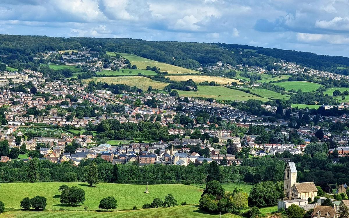
From Selsley Common looking towards Stroud
High view from Selsley Common on the Cotswold escarpment, looking across the valley towards Stroud. Dense houses fill the valley floor and climb the far hillside under a wooded ridge, with patchwork green fields between. In the valley bottom is a large Victorian mill complex with a chimney and a pointed tower. In the foreground are bright mown fields with a memorial column, and a church with a saddleback tower and west rose window. Blue sky with white cumulus, and a small paraglider high in the sky, which falls outside both crops. Summer light, vivid greens.
- Author
- Glacierich
- Licence
- CC BY-SA 4.0
- Source
- From Selsley Common looking towards Stroud.jpg (Wikimedia Commons)
- Changes
- Cropped and resized for this website
-
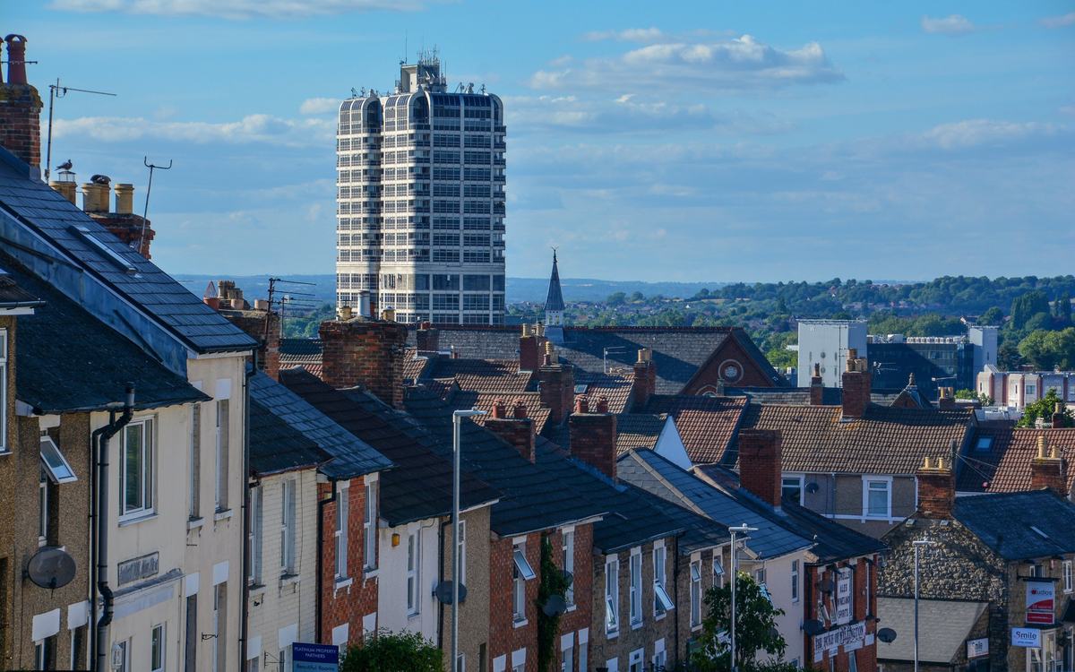
Swindon , Eastcott Hill
Elevated view down the sloping Eastcott Hill in Swindon. Rows of red-brick and rendered terraced houses with slate roofs and chimneys fall away towards the town centre. Swindon's David Murray John Tower rises against a blue sky with white clouds, with a church spire, office blocks and green wooded hills on the horizon. Warm evening light, sharp and vivid. Small incidental signs sit at the bottom edge: a property-letting board, the painted Arkell's lettering on the Duke of Wellington pub, and shop signs at the far right. Part of a car roof is at the bottom right, but no number plate shows.
- Author
- Lewis Clarke
- Licence
- CC BY-SA 2.0
- Source
- Swindon , Eastcott Hill - geograph.org.uk - 7229088.jpg (Wikimedia Commons)
- Changes
- Cropped and resized for this website
-
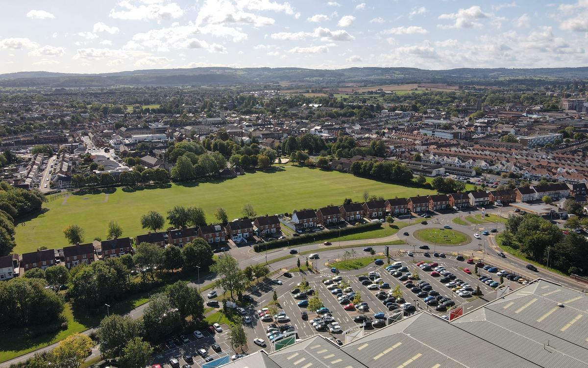
Victoria Park, Taunton
Drone view over Victoria Park, Taunton: a large bright-green park ringed by trees and red-brick houses. Dense terraced streets spread to the horizon, with wooded hills beyond under a blue sky with white cumulus. A roundabout, a supermarket car park and a large grey retail roof are at the lower right.
- Author
- LearningPlock
- Licence
- CC BY-SA 4.0
- Source
- Taunton Victoria Park.jpg (Wikimedia Commons)
- Changes
- Cropped and resized for this website
-
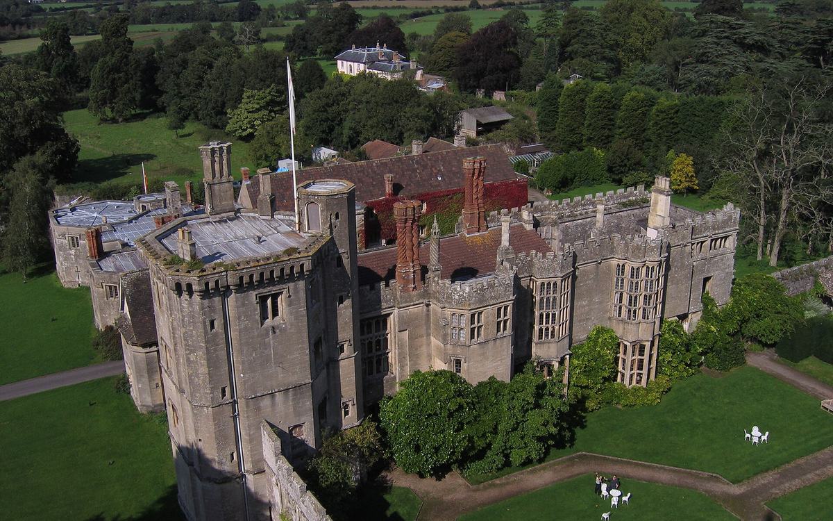
Thornbury Castle and its gardens
Elevated oblique view of Thornbury Castle. The octagonal stone tower, crenellated walls, ornate Tudor twisted brick chimneys and red Virginia creeper stand over manicured lawns and garden paths. Tall trees surround it, with a Georgian house behind and the flat green Severn Vale fields stretching to the horizon. Two small, unidentifiable figures sit at garden tables.
- Author
- Charles Drown
- Licence
- CC BY-SA 2.0
- Source
- Thornbury Castle - geograph.org.uk - 1827425.jpg (Wikimedia Commons)
- Changes
- Cropped and resized for this website
-
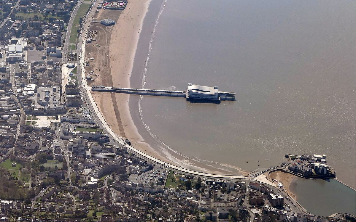
Weston-super-Mare seafront and the Grand Pier at low tide
High aerial view looking south along Weston Bay at low tide on a sunny day. The town centre and seafront road are on the left, with the Grand Pier running out from a wide golden beach. Knightstone Island and the Marine Lake are at the bottom right, and brown Severn estuary water fills the right side. Further up the frame, the beach runs south past a golf course to the winding River Axe and green fields of the Somerset Levels. There is no sky in the frame.
- Author
- Adam Cli
- Licence
- CC BY-SA 4.0
- Source
- WestonSuperMareBeach1.jpg (Wikimedia Commons)
- Changes
- Cropped and resized for this website
-
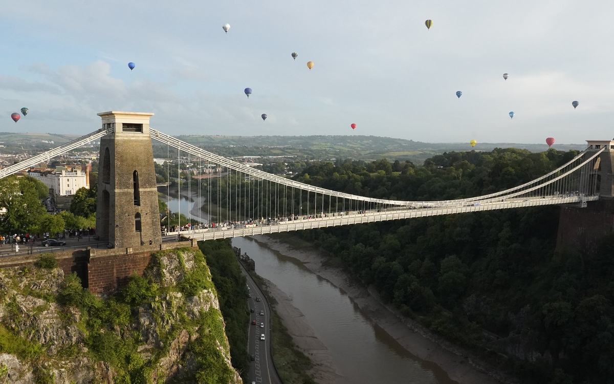
Bristol International Balloon Fiesta mass ascent over the Avon Gorge
Elevated view from the hillside by Clifton Observatory looking across the Clifton Suspension Bridge and Avon Gorge, with about 17 small hot-air balloons (red, blue, yellow, green, white) in a pale blue, lightly clouded evening sky beyond. Below are green gorge woodland, the tidal River Avon with mudbanks and the Portway road. Spectators line the bridge deck and the Clifton side, too small to identify.
- Author
- Steve Knight
- Licence
- CC BY 2.0
- Source
- Bristol International Balloon Fiesta mass ascent 110823 (Flickr)
- Changes
- Cropped and resized for this website
- Used on
- Not currently used on a page


_-_geograph.org.uk_-_8028731.jpg)

.jpg)
_(1).jpg)

,_Rhossili,_Penrhyn_G%C5%B5yr,_Cymru_(Wales)_05.jpg)
.jpg)


.jpg)


.jpg)


